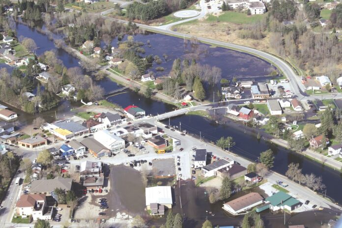
The public will get a look Jan. 29 at the work the County has been doing on floodplain mapping of the Gull and Burnt rivers.
County director of planning, Steve Stone, said on Jan. 10 the “long-awaited” public gathering for the project is scheduled for 3-8 p.m. at the Minden Recreation Centre.
He said the County’s partners, the Ganaraska Conservation Authority, will be on hand for the meeting.
“Cory Harris and his team will be presenting to the public in a very tactile environment over the course of the evening, where people can come in and actually look at the mapping, and request to see how it affects their property,” Stone said.
“All are welcome and it should be an exciting time to see the finished product.”
Stone has said in the past the main purpose of the project “is to prevent loss of lives, property and land caused by flooding.”
Following 2013, 2015, 2017 and 2019 floods, the County partnered with the Ganaraska and Kawartha Region conservation authorities on the work that began in 2017.
It started with phase one, when the County got money under the National Disaster Mitigation Program (NDMP) for LiDAR, an acronym for light detection and ranging, which is laser imaging used to get elevation data. It was done in 2018-19, with data delivered in 2020.
It was also in 2020 that the province launched its flooding strategy in Minden. It called for understanding flood risks, strengthening governance of flood risks, enhancing flood preparedness, response and recovery, and investing in flood risk reduction.
Phase two of the local project involved bathymetric data, which the partners also got NDMP money for. It’s the measurement of the depth of water in rivers or lakes. Bathymetric maps look like topographic maps, with lines to show the shape and elevation of land features. Work on that was done in 2021-2022.
Phases three and four involved technical work, developing hydrologic and hydraulic models, and the flood mapping itself.
The study area is more than 2,800-squarekilometres of drainage; 400-plus kilometres of channels; 23 lakes, 42 dams and key areas within the Parks Canada-TSW system.
Stone noted in the province’s flooding strategy, flooding is the most significant natural hazard in Ontario in terms of death, damage and civil disruption and the costliest natural disaster in Canada in terms of property damage.
He said this project will address the number one priority of understanding flood risks and how they can be mitigated and risk-managed.
“The deliverables of this project will include updated, and where applicable, the creation of new floodplain mapping for the reservoir lakes and the connecting rivers that are frequently impacted by flooding,” he said.
“Updated floodplain mapping will be used to reduce the impact of flooding by directing new development to safer locations and regulating legacy development within the floodplain and flood fringe areas.
“Enhanced knowledge of the location of the flood susceptible areas will allow the County and local municipalities to plan the most efficient emergency response efforts, reducing the impact of flooding on the population and making our communities more resilient”.


